搜索结果: 1-15 共查到“光学工程 data”相关记录152条 . 查询时间(0.286 秒)

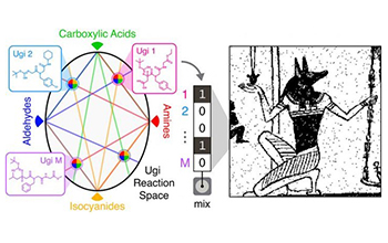
Researchers report progress on molecular data storage system(图)
Researchers report progress molecular data storage system
2020/2/20
A team of National Science Foundation-funded researchers has made substantial progress in creating a new type of data storage system.As the data universe continues to expand, much work is being done t...
DEVELOPMENT OF VIRTUAL REALITY APPLICATION FOR CULTURAL HERITAGE VISUALIZATION FROM MULTI-SOURCE 3D DATA
Virtual Reality Visualization Cultural heritage Multi-source data
2019/3/1
Immersive technologies like Virtual or Augmented Reality (VR/AR) are lately becoming more and more popular in wide range of scientific applications. These technologies provide the most immersive way t...
ON THE ESTIMATION OF POLARIMETRIC PARAMETERS FOR OIL SLICK FEATURE DETECTION FROM HYBRID POL AND DERIVED PSEUDO QUAD POL SAR DATA
SAR RISAT-1 CTLR pseudo-quad pol correlation coefficient sigma naught
2019/2/28
Oil spills in oceans have a significant long term effect on the marine ecosystem and are of prime concern for maritime economy. In order to locate and estimate the oil spread area and for quantitative...
3D CITYGML BUILDING MODELLING FROM LIDAR POINT CLOUD DATA
LiDAR point cloud, CityGML LoD1 LoD Smart Cities D building model
2019/2/27
With recent government initiatives for smart cities, 3D virtual city models are in demand for managing and monitoring the urban infrastructure. 3D building models forms an important component of 3D vi...
AUTOMATED BUILDING DETECTION USING RANSAC FROM CLASSIFIED LIDAR POINT CLOUD DATA
LiDAR RANSAC Building Detection Plane Detection Python LAS Point Cloud
2018/11/8
For the past 10 years, the Philippines has seen and experienced the growing force of different natural disasters and because of this the Philippine governement started an initiative to use LiDAR techn...
COMPARING THE PERFORMANCE OF POINT CLOUD REGISTRATION METHODS FOR LANDSLIDE MONITORING USING MOBILE LASER SCANNING DATA
point clouds, registration methods landslide monitoring mobile laser scanning deviation maps
2018/11/8
The aim of the research is to evaluate the performance of the point cloud registration methods using mobile laser scanning data. The point cloud registration methods involved in this research are matc...
INTEGRATION OF TREE DATABASE DERIVED FROM SATELLITE IMAGERY AND LIDAR POINT CLOUD DATA
Tree Crown Identification and Delineation Canopy Height Model Lidar Point Cloud Camera Model
2018/11/9
3D tree database provides essential information of tree species abundance, spatial distribution and tree height for forest mapping, sustainable urban planning and 3D city modelling. Fusion of passive ...
A SLIDING WINDOW METHOD FOR DETECTING CORNERS OF OPENINGS FROM TERRESTRIAL LIDAR DATA
Sliding Window Corners Detection Openings Detection LiDAR Point Clouds LoD3 Modelling
2018/11/9
Architectural building models (LoD3) consist of detailed wall and roof structures including openings, such as doors and windows. Openings are usually identified through corner and edge detection, base...
TOPOLOGICAL 3D ELEVATION DATA INTERPOLATION OF ASTER GDEM BASED ON CONTINUOUS DEFORMATION
Homotopy continuation 3D Data Interpolation DEM Optimization
2018/11/9
In Geographic Information Science, polynomial methods such as linear estimation and non-polynomial methods including Inverse Distance Weighting and Kriging have been used for elevation data interpolat...
INDOOR SPATIAL DATA CONSTRUCTION FROM TRIANGLE MESH
TriangleMesh Mesh Simplification Solid Indoor Space Indoor Data IndoorGML
2018/11/8
The 3D triangle mesh is widely used to represent indoor space. One of widely used methods of generating 3D triangle mesh data of indoor space is the construction from the point cloud collected using L...
COMBINING HIGH SPATIAL RESOLUTION OPTICAL AND LIDAR DATA FOR OBJECT-BASED IMAGE CLASSIFICATION
High Spatial Resolution Lidar Object-Based Classification Aerial Image Image segmentation
2018/5/14
In order to classify high spatial resolution images more accurately, in this research, a hierarchical rule-based object-based classification framework was developed based on a high-resolution image wi...
METHODS FROM INFORMATION EXTRACTION FROM LIDAR INTENSITY DATA AND MULTISPECTRAL LIDAR TECHNOLOGY
Classification Information Extraction LiDAR Intensity Multispectral LiDAR
2018/5/15
LiDAR is a consolidated technology for topographic mapping and 3D reconstruction, which is implemented in several platforms On the other hand, the exploitation of the geometric information has been co...
A VOXEL-BASED FILTERING ALGORITHM FOR MOBILE LIDAR DATA
Mobile LiDAR filtering voxelization upward growing curvature
2018/5/15
This paper presents a stepwise voxel-based filtering algorithm for mobile LiDAR data. In the first step, to improve computational efficiency, mobile LiDAR points, in xy-plane, are first partitioned in...
A THREE-DIMENSIONAL AEROSOL VARIATIONAL DATA ASSIMILATION SYSTEM FOR AIRCRAFT AND SURFACE OBSERVATIONS
Data assimilation WRF/Chem Aerosol Aircraft
2018/5/16
A three-dimensional variational data assimilation system is implemented within the Weather Research and Forecasting/Chemistry model, and the control variables consist of eight species of the Model for...
DECOMPOSITION TECHNIQUES FOR ICESAT/GLAS FULL-WAVEFORM DATA
ICESat/GLAS Full-Waveform Waveform Decomposition Method Overlapped Echo Components Levenberg-Marquard (LM) Optimization Method
2018/5/15
The geoscience laser altimeter system (GLAS) on the board Ice, Cloud, and land Elevation Satellite (ICESat), is the first long-duration space borne full-waveform LiDAR for measuring the topography of ...

