搜索结果: 1-15 共查到“摄影测量与遥感技术 Remote sensing”相关记录751条 . 查询时间(0.125 秒)

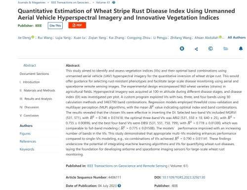
中国农业大学植物保护学院马占鸿教授团队在IEEE Transactions on Geoscience and Remote Sensing发表研究成果(图)
马占鸿 IEEE Transactions on Geoscience and Remote Sensing 小麦条锈病 遥感
2023/12/11

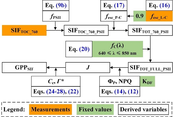
Remote Sensing of Environment刊发中国科学院水利部水土保持研究所吕肖良研究员团队日光诱导叶绿素荧光研究工作进展(图)
吕肖良 日光诱导 叶绿素荧光 SIF GPP
2022/6/8

同济大学测绘与地理信息学院王群明教授课题组本科生在遥感领域顶级期刊《Remote Sensing of Environment》发表论文:Blocks-removed spatial unmixing for downscaling MODIS images(图)
同济大学 测绘与地理信息学院 王群明 教授 课题组 遥感领域 顶级期刊
2021/3/18
近日,同济大学测绘与地理信息学院王群明教授课题组在遥感领域顶级期刊《Remote Sensing of Environment》发表了1篇论文。本研究受到国家自然基金项目(41971297)资助。

电子科技大学资源与环境学院定量遥感团队在《ISPRS Journal of Photogrammetry and Remote Sensing》发表研究成果(图)
电子科技大学资源与环境学院 定量遥感 热红外 遥感信息处理 参数反演
2020/8/6
近日,我校资环学院定量遥感团队周纪课题组在卫星被动微波与热红外遥感信息处理和参数反演方面取得重要研究进展。他们在遥感领域顶级期刊《ISPRS Journal of Photogrammetry and Remote Sensing》(一区期刊,影响因子7.319;为国际摄影测量与遥感协会ISPRS会刊)发表了题为“Estimation of 1-km all-weather remotely se...
中国南极测绘研究中心庞小平教授团队海冰遥感研究成果在《Remote Sensing of Environment》发表
中国南极测绘研究中心 庞小平 教授 海冰遥感 研究成果 《Remote Sensing of Environment》
2020/9/7
通过更高分辨率的热红外影像,我们能发现北极海冰的哪些有趣特性?近日,我中心博士生范沛为第一作者,赵羲副教授为通讯作者的研究论文在《环境遥感》发表。该研究基于Landsat 8 TIRS热红外影像,验证了几种经典的温度反演算法在北极海冰区域的精度,并对冰间水道和海冰边缘带的温度特征进行了分析。
LANDSLIDE HAZARD ZONATION MAPPING OF CHAMOLI LANDSLIDES IN REMOTE SENSING AND GIS ENVIRONMENT
Landslides Chamoli Remote Sensing Hazard, Himalaya
2019/2/27
Landslides are very common problem in hilly terrain. Chamoli region of Himalaya is highest sensitive zone of the landslide hazards. The purpose of Chamoli landslide study, to observe the important ter...
IDENTIFICATION OF IRON OXIDES MINERALS IN WESTERN JAHAJPUR REGION, INDIA USING AVIRIS-NG HYPERSPECTRAL REMOTE SENSING
AVIRIS-NG Iron-oxide Limonite Western Jahajpur belt Hyperspectral remote sensing
2019/2/27
Hyperspectral remote sensing is being considered as an advanced technique for mineral identification of surficial deposits. In this research different iron oxides minerals such as limonite, goethite h...
MULTITEMPORAL ANALYSIS OF FOREST COVER CHANGE USING REMOTE SENSING AND GIS OF KANHA TIGER RESERVE, CENTRAL INDIA
Forest LULC Livelihood Climate Change Adaptation
2019/2/27
Forest ecosystems play a key role in global ecological balance and provide a variety of tangible and intangible ecosystem services that support the livelihoods of rural poor. In addition to the anthro...
ROAD EXTRACTION TECHNIQUES FROM REMOTE SENSING IMAGES: A REVIEW
Remote Sensing Image Classification Road Extraction Road Feature
2018/11/9
The importance of analysis high resolution satellite imagery plays an important research topic for geographical information analysis of cities. Geospatial data plays an important role in important iss...
ROOFING ASSESSMENT FOR ROOFTOP RAINWATER HARVESTING ADOPTION USING REMOTE SENSING AND GIS APPROACH
Remote sensing GIS, rooftop rainwater harvesting geospatial environment
2018/11/8
Rooftop rainwater harvesting refers to the collection and storage of water from rooftops whereby the quality of harvested rainwater depend on the types of roof and the environmental conditions. This s...
LAND USE CLASSIFICATION FROM COMBINED USE OF REMOTE SENSING AND SOCIAL SENSING DATA
Human Behavior Social Sensing Remote Sensing Decision Tree Geographic Information System Accuracy Assessment
2018/11/9
Large amounts of data can be sensed and analyzed to discover patterns of human behavior in cities for the benefit of urban authorities and citizens, especially in the areas of traffic forecasting, urb...
URBAN BOUNDARY EXTRACTION AND URBAN SPRAWL MEASUREMENT USING HIGH-RESOLUTION REMOTE SENSING IMAGES: A CASE STUDY OF CHINA’S PROVINCIAL
Urban boundary Urban sprawl High-resolusion remote sensing image Provincial capitals
2018/5/15
Urban boundary is an important indicator for urban sprawl analysis. However, methods of urban boundary extraction were inconsistent, and construction land or urban impervious surfaces was usually used...
INSTANTANEOUS COASTLINE EXTRACTION FROM LIDAR POINT CLOUD AND HIGH RESOLUTION REMOTE SENSING IMAGERY
coastline image segmentation LiDAR region growing
2018/5/14
A new method was proposed for instantaneous waterline extraction in this paper, which combines point cloud geometry features and image spectral characteristics of the coastal zone. The proposed method...
AUTOMATIC EXTRACTION OF URBAN BUILT-UP AREA BASED ON OBJECT-ORIENTED METHOD AND REMOTE SENSING DATA
Urban built-up area Construction land Object-oriented method Remote sensing Automatic extraction
2018/5/14
Built-up area marks the use of city construction land in the different periods of the development, the accurate extraction is the key to the studies of the changes of urban expansion. This paper studi...
REMOTE SENSING OBSERVATIONS AND NUMERICAL SIMULATION FOR MARTIAN LAYERED EJECTA CRATERS
Martian Surface Impact Crater Remote Sensing Morphological Characteristic Numerical Simulation
2018/5/14
To understand past Martian climates, it is important to know the distribution and nature of water ice on Mars. Impact craters are widely used ubiquitous indicators for the presence of subsurface water...


