
搜索结果: 1-15 共查到“大地测量学 GEO”相关记录15条 . 查询时间(0.203 秒)
首先从参数估计、精度评定和质量控制角度论证了在精密定位中随机模型的重要性;然后基于短基线单差观测模型,采用严密的方差分量估计方法计算了不同频率、不同卫星的相位和伪距观测值精度,任意频率之间的交叉相关性以及不同频率的相位和伪距观测值在不同时间间隔上的时间相关性;随后分析了随机模型对基线精度和整体检验统计量的影响。结果表明:北斗用户接收机数据精度都与高度角相关,建议采用高度角指数加权函数;北斗二号3个...
FORMULATION OF GEO-SPATIAL SOLUTION FOR DISASTER MANAGEMENT
emergency disaster flood disaster management disaster errors information system decision process geospatial data mobile and web based geo-spatial data model geo-spatial maps quick information portal
2016/3/17
Mumbai city has become extremely vulnerable due to a large population living in huts especially in low-lying areas. Whenever city receives heavy rains; roads get waterlogged and the traffic is disrupt...
Monitoring the Recovery Process of the Disaster-Affected Areas -Scaling Context Image Analysis in GEO Grid-Based Solution
Disaster Management Satellite Remote Sensing Change Detection Image Understanding
2015/12/18
This paper presents a new remotely sensed solution for monitoring the recovery of a large disaster-affected area. It exploits the powerful data grid and computing grid technologies developed on GEO (G...
Evaluation of Large-Scale Storage Systems for Satellite Data in GEO Grid
Data Archiving Analysis Spatial Information Sciences Global-Environmental-Databases
2015/12/18
The Global Earth Observation (GEO) Grid infrastructure is an E-Science infrastructure which enables global research activity and drives geosciences to get a significant discovery or achievement in the...
A Study on Ontology-Driven Geo-Information Retrieval Mechanism in the Semantic Web
Semantic Web Geo-Ontolog Intelligent Search Engine Semantic Web Services
2015/12/2
Firstly, this paper expounded that the traditional searching based on keywords has a severe deficiency on Recall and Precision because the computer can’t understand what information mean efficiently. ...
The availability of high-resolution satellite imagery with stereo viewing capability coupled to unrestricted commercial availably and
a good geometric accuracy has made the satellite imagery a possib...
UPDATION AND POSITIONAL ACCURACY IMPROVEMENT OF GEO SPATIAL DATA-INNOVATIONS AT KAMPSAX INDIA PRIVATE LIMITED
PAI New mapping Updation Transformations Geometric fidelity
2015/6/1
Kampsax India Private Limited (KIL) is engaged in the production of very large mapping projects from all over the world though mainly from Europe and Latin America with over 35 digital Photogrammetric...
METASPACE: FROM A MODEL OF SPATIAL CONTIGUITY TO THE CONCEPTUALIZATION OF SPACE IN GEO-ANALYSES
METASPACE SPATIAL CONTIGUITY CONCEPTUALIZATION SPACE IN GEO-ANALYSES
2015/3/17
METASPACE: FROM A MODEL OF SPATIAL CONTIGUITY TO THE CONCEPTUALIZATION OF SPACE IN GEO-ANALYSES.
EXTENDING GEO-INFORMATION SERVICES: A VIRTUAL ARCHITECTURE FOR SPATIAL DATA INFRASTRUCTURES
EXTENDING GEO-INFORMATION SERVICES VIRTUAL ARCHITECTURE SPATIAL DATA INFRASTRUCTURES
2015/3/16
EXTENDING GEO-INFORMATION SERVICES: A VIRTUAL ARCHITECTURE FOR SPATIAL DATA INFRASTRUCTURES.
CANADIAN GEO-SPATIAL STANDARDS IN ACTION.
EXTENDING GEO-SPATIAL REPOSITORIES WITH GEO-SEMANTIC PROXIMITY. FUNCTIONALITIES TO FACILITATE THE INTEROPERABILITY OF GEO-SPATIAL DATA
EXTENDING GEO-SPATIAL REPOSITORIES GEO-SEMANTIC FUNCTIONALITIES INTEROPERABILITY GEO-SPATIAL DATA
2015/3/16
EXTENDING GEO-SPATIAL REPOSITORIES WITH GEO-SEMANTIC PROXIMITY. FUNCTIONALITIES TO FACILITATE THE INTEROPERABILITY OF GEO-SPATIAL DATA.
GEO-SPATIAL DATA HANDLING FOR WEB-BASED AND MOBILE APPLICATIONS
GEO-SPATIAL DATA HANDLING WEB-BASED MOBILE APPLICATIONS
2015/3/16
GEO-SPATIAL DATA HANDLING FOR WEB-BASED AND MOBILE APPLICATIONS.
STATISTICAL AND GEO-STATISTICAL ANALYSIS OF WIND: A CASE STUDY OF DIRECTION STATISTICS
STATISTICAL GEO-STATISTICAL WIND DIRECTION STATISTICS
2015/3/16
STATISTICAL AND GEO-STATISTICAL ANALYSIS OF WIND: A CASE STUDY OF DIRECTION STATISTICS.
THE DESIGN IDEA AND FEATURE OF CHINESE NATIONAL GEO-SPATIAL DATA TRANSFER FORMAT
Spatial Data Transfer format Data sharing Data standards Data exchange CNSDTF
2015/1/23
Geo-Spatial Data Transfer Standard is an important part of "National Spatial Data Infrastructure (NSDI)", as well as a necessary means for data sharing. "Chinese National Geo-Spatial Data Transfer For...
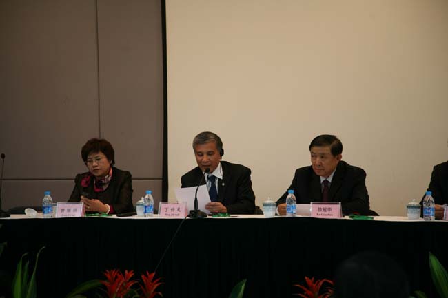
丁仲礼出席 GEO “构建全球农业监测综合系统”国际研讨会高层政策会议(图)
中国科学院遥感应用研究所 丁仲礼 研讨会 农业监测
2009/12/18
2009年2月11日-13日,地球观测组织(GEO)“构建全球农业监测综合系统”国际研讨会在遥感应用研究所举行。13日下午中国科学院副院长丁仲礼院士,全国政协教科文卫体委员会主任、科技部原部长徐冠华院士,地球观测组织(GEO)联合主席、中国气象局局长郑国光博士,国家粮食局副局长曾丽瑛、全球陆地系统综合观测计划(IGOL)联合主席、美国马里兰大学地理系主任John Townshend及地理系教授Ch...