搜索结果: 1-4 共查到“水文学 3-D images”相关记录4条 . 查询时间(0.156 秒)

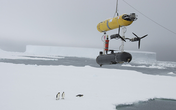
Unmanned underwater vehicle provides first 3-D images of underside of Antarctic sea ice(图)
Antarctic sea ice 3-D images
2014/12/1
A video news release and b-roll are available by contacting Dena Headlee, (703) 292-7739 / dheadlee@nsf.gov
A National Science Foundation (NSF)-funded research team has successfully tested an autonom...
FOREST MANAGEMENT PLANNING FOR SOIL CONSERVATION USING SATELLITE IMAGES, GIS MAPPING, AND SOIL EROSION MODELING
Soil conservation planning watersheds physical reconnaissance surveys
2009/10/12
Soil conservation planning in inaccessible mountainous watersheds is a very tedious and expensive job. Generally, in India most soil conservation programs are carried out with physical reconnaissance ...
Elevation based correction of snow coverage retrieved from satellite images to improve model calibration
snow coverage satellite images
2009/7/22
The most widely used method for snow dynamic simulation relies on temperature index approach, that makes snow melt and accumulation processes depend on air temperature related parameters. A recently u...
Unsupervised classification of saturated areas using a time series of remotely sensed images
hydrologically active areas Normalized Difference Water Index
2009/5/13
The spatial distribution of saturated areas is an important consideration in numerous applications, such as water resource planning or siting of management practices. However, in humid well vegetated ...

