搜索结果: 1-15 共查到“U.S. East Coast”相关记录15条 . 查询时间(0.051 秒)

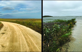
U.S. East Coast sea level rise in 20th century fastest in 2,000 years(图)
U.S. East Coast sea level rise 20th century 2,000 years
2021/4/9
The rate of sea level rise in the 20th century along much of the U.S. Atlantic coast was the fastest in 2,000 years, and southern New Jersey had the fastest rates, according to a Rutgers Universi...
REMOTE SENSING AND GIS BASED APPROACH FOR ENVIRONMENTAL SENSITIVITY STUDIES A CASE STUDY FROM INDIAN EAST COAST
Land Cover Ecology Environment GIS Impact Analysis
2015/7/30
In the wake of Earth Summit – 2002 resolutions, and also the recently omni-prevalent environmental awareness across the globe, it
has become imperative to pay attention to environmental concerns, an...
TECHNICS OF REMOTE SENSING AND GEOGRAPHIC INFORMATION SYSTEM APPLIED IN CLIMATE ACTION PROJECT IN EAST COAST OF PARANA STATE
Climate Global GIS Application Photogrammetry
2015/7/29
The SPVS, Society of Research in Wild Life executes, among others activities, with partnership of the TNC (The Nature
Conservancy) and financing of Texaco, General Motors and American Electric Power...
MONITORING AND IMPACT ASSESSMENT OF SHRIMP FARMING IN THE EAST COAST OF THAILAND USING REMOTE SENSING AND GIS
Coastal Zones
2015/2/3
A phenomenal growth of Intensive shrimp faring has been seen in the Chanthaburi province in the East Coast of
Thailand since its inception in late 1988. The province got more attention after failure ...
Time Series Analysis Of Primary Productivity Along The East Coast Of India Using Oceansat-2 Ocean Colour Monitor (O cm)
Primary Productivity VGPM model OCM-2 MODIS-a Comparison
2014/12/16
Primary Productivity is the ultimate source of energy for all organisms in an ecosystem. It is associated with the food production and the global carbon cycle. Sensors on remote platforms (satellites)...
Seasonal variability of phytoplankton blooms in the coastal waters along the East coast of India
Phytoplankton Blooms Variability Coastal Waters OCM-2
2014/12/16
Bay of Bengal (BOB) is a semi enclosed tropical basin located in the north eastern part of the Indian Ocean with high influence of fresh water discharge from major rivers and rainfall. Bay of Bengal (...
Studies on textural characteristics of Erra Kalva River, West Godavari District, Andhra Pradesh, East coast of India
Sediment texture Erra kalva river Sediment bar and Channel bar
2014/11/17
The detailed textural study of Errakalva river (lat. 160
50'
- 170
20' N: long. 810 0
'
- 810
40' E)
has been carried out. A total of forty samples from thirteen stations were collected al...
Impact of Iron Ore Tailing on Foraminifera of the Uppateru River Estuary, East Coast of India
Iron Ore Tailing Foraminifera Pollution Mining Uppateru East coast Of India
2013/3/12
Benthic foraminiferal assemblages have been used to determine the effects of Iran ore tailing pollution on the marine environment. The present paper attempts to unveil pollution impact as responded by...
Numerical simulation and first-order hazard analysis of large co-seismic tsunamis generated in the Puerto Rico trench: near-field impact on the North shore of Puerto Rico and far-field impact on the US East Coast
Numerical simulation first-order hazard analysis large co-seismic tsunamis generated the Puerto Rico trench
2010/10/21
We perform numerical simulations of the coastal impact of large co-seismic tsunamis, initiated in the Puerto Rican trench, both in far-field areas along the upper US East coast (and other Caribbean is...
Carbonate mineral saturation states along the U.S. East Coast
Carbonate mineral saturation states the U.S. East Coast
2014/4/17
To assess the impact of ocean acidification on the carbonate chemistry of the shelf waters off the southeastern
United States (South Atlantic Bight [SAB]), we measured carbonate mineral saturation st...

Scientists Target East Coast Rocks For CO2 Storage(图)
Scientists Target East Coast Rocks CO2 Storage buried volcanic rocks Power Plants
2010/1/8
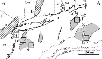
Scientists say buried volcanic rocks along the heavily populated coasts of New York, New Jersey and New England, as well as further south, might be ideal reservoirs to lock away carbon dioxide emitted...
Hydrogeology and the rate at which freshwater is taken from coastal aquifers controls the intrusion of saline water. The phenomenon is common in the extensive coastal sedimentary deposits and the delt...
Salinity Variations as an Indicator of the Rate of Water Transport Along the East Coast of the Bothnian Sea
Salinity Variations Indicator Rate of Water Transport East Coast of the Bothnian Sea
2009/6/18
Salinity Variations as an Indicator of the Rate of Water Transport Along the East Coast of the Bothnian Sea.
Gulf Stream Boundary Eddies off the East Coast of Florida
Gulf Stream Boundary Eddies East Coast of Florida
2009/2/13
Satellite infrared data and in situ data were used to study eddies off the east coast of Florida. The surface thermal manifestation of the eddies identified in the infrared data were alternating cold ...
Sea Level on the U.S. East Coast: Decadal Variability Caused by Open Ocean Wind-Curl Forcing
Sea Level U.S. East Coast Decadal Variability Open Ocean Wind-Curl Forcing
2008/7/2
One of the puzzling features of sea level on the east coast of the United States is the decedal-scale variability;the fluctuations are 10–15 cm, peak to peak, at periods longer than a few years. The a...

