
�������: 61-75 ���鵽��SAR����ؼ�¼1384�� . ��ѯʱ��(0.125 ��)
THE RESEARCH ON DRYLAND CROP CLASSIFICATION BASED ON THE FUSION OF SENTINEL-1A SAR AND OPTICAL IMAGES
Crop Classification Fusion Sentinel-1A Synthetic Aperture Radar Object-Oriented Technique
2018/5/15
In recent years, the quick upgrading and improvement of SAR sensors provide beneficial complements for the traditional optical remote sensing in the aspects of theory, technology and data. In this pap...
A MATCHING METHOD TO REDUCE THE INFLUENCE OF SAR GEOMETRIC DEFORMATION
SAR image image matching SURF SNCC geometrical deformations
2018/5/14
There are large geometrical deformations in SAR image, including foreshortening, layover, shade��which leads to SAR Image matching with low accuracy. Especially in complex terrain area, the control poi...
EXPLORING THE APPLICABILITY OF SEMI-GLOBAL MATCHING FOR SAR-OPTICAL STEREOGRAMMETRY OF URBAN SCENES
TerraSAR-X WorldView-2 dense matching semi-global matching (SGM) data fusion SAR-optical stereogrammetry
2018/6/4
Nowadays, a huge archive of data from different satellite sensors is available for diverse objectives. While every new sensor provides data with ever higher resolution and more sophisticated special p...
COLORIZING SENTINEL-1 SAR IMAGES USING A VARIATIONAL AUTOENCODER CONDITIONED ON SENTINEL-2 IMAGERY
Synthetic aperture radar (SAR) optical remote sensing Sentinel-1 Sentinel-2 deep learnig data fusion
2018/6/5
In this paper, we have shown an approach for the automatic colorization of SAR backscatter images, which are usually provided in the form of single-channel gray-scale imagery. Using a deep generative ...
�й���ѧԺ����ѧ�о����Ȼ�ȡ��һ������SAR����ʱ��������ͼ��ͼ��
�й���ѧԺ����ѧ�о��� ����SAR���� ʱ��������ͼ
2018/3/20
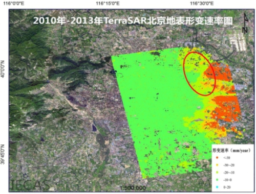
���գ��й���ѧԺ����ѧ�о����о�Ա��Т�ס��ױ������й���Դ����Ӧ�����ģ������õ���һ���߷����������״�ʱ����棨TSInSAR���ر��α����ͼ��ʵ���ҹ������״�ʱ�����������ͻ�ƣ��óɹ��״ν������״����ǵر������α���������������ȣ���־���ҹ������Ǻϳɿ��״��������о�����ﵽ�����Ƚ�ˮƽ�������״�ʱ����漼����TSInSAR����һ�����������״��ʱ������ݸ������ԭ����ʵ��800����̫...
��Լ���SARͼ���ڼල����ʱ�����˹���ע������ʱ�����Լ�dz��ṹѧϰ�㷨�ı���������������,���һ�ֻ����������ѧϰ�ļ���SARͼ������������,�Բ������ݽ��ж��ּ���������ȡ,�Ա�����������ͼ����Ϣ; �ڴ˻�����,ͨ���Զ��������Դ����ޱ���������зǼලѧϰ,��ȡ���߿ɷ��ԺͲ����Ե��������; Ȼ��,���������������ѵ��������,�����Զ�����������,�Լලѧϰ�ķ�ʽ����������; ���,ͨ��...
COHERENT CHANGE DETECTION FOR REPEATED-PASS INTERFEROMETRIC SAR IMAGES: AN APPLICATION TO EARTHQUAKE DAMAGE ASSESSMENT ON BUILDINGS
Building Damages Coherent Change Detection Disasters Earthquake Synthetic Aperture Radar
2018/4/18
During disaster response, the availability of relevant information, delivered in a proper format enabling its use among the different actors involved in response efforts, is key to lessen the impact o...
DIFFERENTIAL SAR INTERFEROMETRY TECHNIQUE FOR CONTROL OF LINEAR INFRASTRUCTURES AFFECTED BY GROUND INSTABILITY PHENOMENA
linear infrastructures landslides monitoring DInSAR surface displacements damage
2018/4/18
The Italian territory is strongly affected by ground instability phenomena and the occurrence of geological events, such as landslides and subsidence, is one of the main causes of damage to linear inf...
COHERENT CHANGE DETECTION FOR REPEATED-PASS INTERFEROMETRIC SAR IMAGES: AN APPLICATION TO EARTHQUAKE DAMAGE ASSESSMENT ON BUILDINGS
Building Damages Coherent Change Detection Disasters Earthquake Synthetic Aperture Radar
2018/5/8
During disaster response, the availability of relevant information, delivered in a proper format enabling its use among the different actors involved in response efforts, is key to lessen the impact o...
POST-HURRICANE DAMAGE ASSESSMENT ON GREENHOUSE FIELDS WITH USE OF SAR DATA
SAR Tornadoes Disaster Management Greenhouses Remote Sensing SENTİ NEL
2018/4/18
Hurricanes occur without any control of human-being, and it causes large scale loss of life and properties. They happen in the very short timeline and cannot be stopped by the people after it starts t...
DETECTION OF LANDSLIDES WITH SAR POLARYMETRY: CASE STUDY OF SOUTH-EASTERN COLOMBIA
Backscattering Coefficient Dispersion Mechanism Landslides Polarimetry SAR (PolSAR) Entropy �C Alpha Parameter Classification Principal Component Analysis
2018/4/18
SAR polarimetry (PolSAR) is a method that can be used to investigate landslides. Polarimetric scattering power decomposition allows to separate the total power received by the SAR antenna, which is di...
DIFFERENTIAL SAR INTERFEROMETRY TECHNIQUE FOR CONTROL OF LINEAR INFRASTRUCTURES AFFECTED BY GROUND INSTABILITY PHENOMENA
linear infrastructures landslides monitoring DInSAR surface displacements damage
2018/5/8
The Italian territory is strongly affected by ground instability phenomena and the occurrence of geological events, such as landslides and subsidence, is one of the main causes of damage to linear inf...
EXPLOITING MULTI-TEMPORAL SENTINEL-1 SAR DATA FOR FLOOD EXTEND MAPPING
Flood Disaster Sentinel-1 Threshold Change detection Deep learning
2018/4/18
Recently, global climate change is one of the biggest challenges in the world. Dense downfall and following catastrophic floods are one of the most destructive natural hazards among all. Consequences ...
POST-HURRICANE DAMAGE ASSESSMENT ON GREENHOUSE FIELDS WITH USE OF SAR DATA
SAR Tornadoes Disaster Managemen zGreenhouses Remote Sensing SENTİ NEL
2018/5/8
Hurricanes occur without any control of human-being, and it causes large scale loss of life and properties. They happen in the very short timeline and cannot be stopped by the people after it starts t...
DETECTION OF LANDSLIDES WITH SAR POLARYMETRY: CASE STUDY OF SOUTH-EASTERN COLOMBIA
Backscattering Coefficient Dispersion Mechanism Landslides Polarimetry SAR (PolSAR) Entropy �C Alpha Parameter Classification Principal Component Analysis
2018/5/8
SAR polarimetry (PolSAR) is a method that can be used to investigate landslides. Polarimetric scattering power decomposition allows to separate the total power received by the SAR antenna, which is di...
�й��о����������а�-��
- ���ڼ���...
�й�ѧ���ڿ����а�-��
- ���ڼ���...
�����ѧ���л������а�-��
- ���ڼ���...
�й���ѧ���а�-��
- ���ڼ���...
�ˡ���-ƪ
- ���ڼ���...
�Ρ���-ƪ
- ���ڼ���...
��������-ƪ
- ���ڼ���...
�������� -ƪ
- ���ڼ���...
֪ʶҪ��-ƪ
- ���ڼ���...
���ʶ�̬-ƪ
- ���ڼ���...
��������-ƪ
- ���ڼ���...
ѧ��ָ��-ƪ
- ���ڼ���...
ѧ��վ��-ƪ
- ���ڼ���...