搜索结果: 46-60 共查到“Remote Sensing”相关记录1234条 . 查询时间(0.329 秒)
ROAD EXTRACTION TECHNIQUES FROM REMOTE SENSING IMAGES: A REVIEW
Remote Sensing Image Classification Road Extraction Road Feature
2018/11/9
The importance of analysis high resolution satellite imagery plays an important research topic for geographical information analysis of cities. Geospatial data plays an important role in important iss...
ROOFING ASSESSMENT FOR ROOFTOP RAINWATER HARVESTING ADOPTION USING REMOTE SENSING AND GIS APPROACH
Remote sensing GIS, rooftop rainwater harvesting geospatial environment
2018/11/8
Rooftop rainwater harvesting refers to the collection and storage of water from rooftops whereby the quality of harvested rainwater depend on the types of roof and the environmental conditions. This s...
LAND USE CLASSIFICATION FROM COMBINED USE OF REMOTE SENSING AND SOCIAL SENSING DATA
Human Behavior Social Sensing Remote Sensing Decision Tree Geographic Information System Accuracy Assessment
2018/11/9
Large amounts of data can be sensed and analyzed to discover patterns of human behavior in cities for the benefit of urban authorities and citizens, especially in the areas of traffic forecasting, urb...
OPEN FORIS AND GOOGLE EARTH ENGINE LINKING EXPERT PARTICIPATION WITH NATURAL RESOURCE MAPPING AND REMOTE SENSING TRAINING IN TANZANIA
Open source earth observation remote sensing geospatial cloud computing crowdsourcing training Tanzania
2018/11/8
There is an increasing amount of open Earth observation (EO) data available, offering solutions to map, assess and monitor natural resources and to obtain answers to global and local societal challeng...

兰州大学资源环境学院张廷军教授团队在国际遥感顶级期刊 Remote Sensing of Environment发表研究论文(图)
兰州大学资源环境学院 张廷军 教授 国际遥感顶级期刊 Remote Sensing of Environment 研究论文
2018/7/3
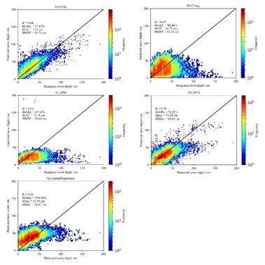
近日,兰州大学资源环境学院2015级硕士研究生肖雄新和张廷军教授(通讯作者)及合作者在国际顶级期刊《Remote Sensing of Environment》发表了题为“Support vector regression snow-depth retrieval algorithm using passive microwave remote sensing data”的研究成果。该研究受到国家...
URBAN BOUNDARY EXTRACTION AND URBAN SPRAWL MEASUREMENT USING HIGH-RESOLUTION REMOTE SENSING IMAGES: A CASE STUDY OF CHINA’S PROVINCIAL
Urban boundary Urban sprawl High-resolusion remote sensing image Provincial capitals
2018/5/15
Urban boundary is an important indicator for urban sprawl analysis. However, methods of urban boundary extraction were inconsistent, and construction land or urban impervious surfaces was usually used...
INSTANTANEOUS COASTLINE EXTRACTION FROM LIDAR POINT CLOUD AND HIGH RESOLUTION REMOTE SENSING IMAGERY
coastline image segmentation LiDAR region growing
2018/5/14
A new method was proposed for instantaneous waterline extraction in this paper, which combines point cloud geometry features and image spectral characteristics of the coastal zone. The proposed method...
INFORMATION EXTRACTION OF TOURIST GEOLOGICAL RESOURCES BASED ON 3D VISUALIZATION REMOTE SENSING IMAGE
Remote sensing image 3D visualization Tourism geological resources Information Extraction Investigation
2018/5/15
Tourism geological resources are of high value in admiration, scientific research and universal education, which need to be protected and rationally utilized. In the past, most of the remote sensing i...
CONSTRUCTION AND APPLICATION OF ENHANCED REMOTE SENSING ECOLOGICAL INDEX
Enhanced Remote Sensing Ecological Index Ecosystem Ecological Environment Quality
2018/5/15
In order to monitor the change of regional ecological environment quality, this paper use MODIS and DMSP / OLS remote sensing data, from the production capacity, external disturbance changes and human...
COUPLE GRAPH BASED LABEL PROPAGATION METHOD FOR HYPERSPECTRAL REMOTE SENSING DATA CLASSIFICATION
Graph Label Propagation Semi-Supervised method Classification Hyperspectral Remote Sensing
2018/5/15
Graph based semi-supervised classification method are widely used for hyperspectral image classification. We present a couple graph based label propagation method, which contains both the adjacency gr...
AUTOMATIC EXTRACTION OF URBAN BUILT-UP AREA BASED ON OBJECT-ORIENTED METHOD AND REMOTE SENSING DATA
Urban built-up area Construction land Object-oriented method Remote sensing Automatic extraction
2018/5/14
Built-up area marks the use of city construction land in the different periods of the development, the accurate extraction is the key to the studies of the changes of urban expansion. This paper studi...
REMOTE SENSING OBSERVATIONS AND NUMERICAL SIMULATION FOR MARTIAN LAYERED EJECTA CRATERS
Martian Surface Impact Crater Remote Sensing Morphological Characteristic Numerical Simulation
2018/5/14
To understand past Martian climates, it is important to know the distribution and nature of water ice on Mars. Impact craters are widely used ubiquitous indicators for the presence of subsurface water...
THE APPLICATION OF CHINESE HIGH-SPATIAL-RESOLUTION REMOTE SENSING SATELLITE IMAGE IN LAND LAW ENFORCEMENT INFORMATION EXTRACTION
land use high resolution batch process geoprocessing model information extraction mapping
2018/5/15
Chinese high -resolution (HR) remote sensing satellites have made huge leap in the past decade. Commercial satellite datasets, such as GF-1, GF-2 and ZY-3 images, the panchromatic images (PAN) resolut...
VEGETATION MONITORING BY REMOTE SENSING TECHNOLOGY FOR UNINHABITED ISLANDS OF THE XISHA ISLANDS
the Xisha Islands Remote Sensing Uninhabited Island Vegetation Remote Vegetation Monitoring Island Development
2018/5/14
The Xisha islands are tropical coral islands in the south sea of China, with special ecological environment. As far away from the inland, they are more sensitive to climate change than inland, and are...
APPLICATION OF MULTI-SOURCE REMOTE SENSING IMAGE IN YUNNAN PROVINCE GRASSLAND RESOURCES INVESTIGATION
Remote Sensing Image Grassland Resources NDVI Grassland Degradation Vegetation Coverage Ecological Protection
2018/5/14
Trough mastering background information of Yunnan province grassland resources utilization and ecological conditions to improves grassland elaborating management capacity, it carried out grassland res...

