
�������: 31-45 ���鵽����ѧ Low Cost����ؼ�¼161�� . ��ѯʱ��(0.04 ��)
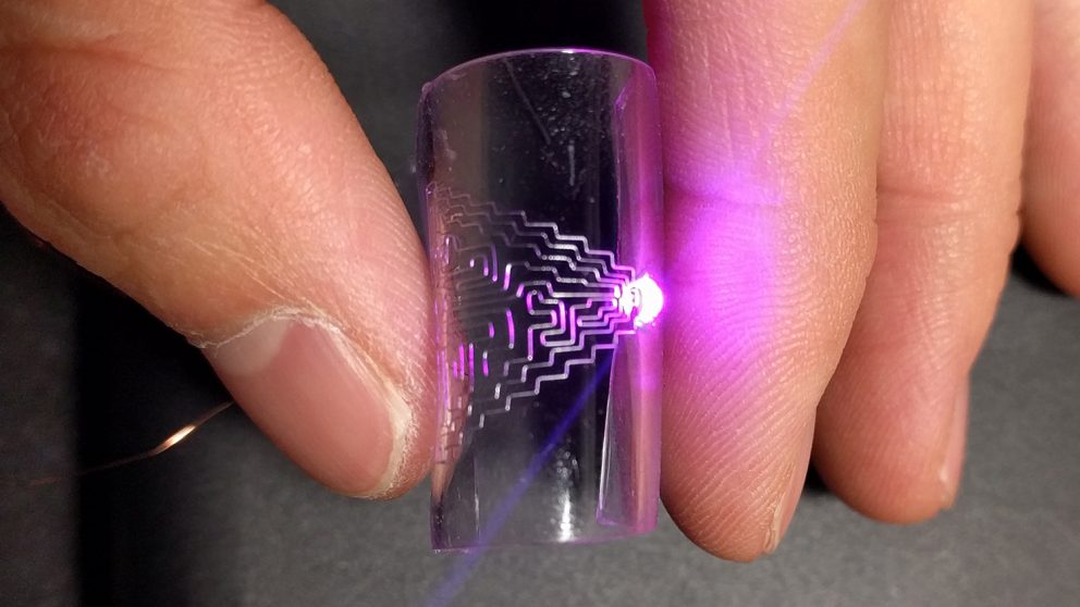
Metal Printing Offers Low-Cost Way to Make Flexible,Stretchable Electronics��ͼ��
Metal Printing Low-Cost Make Flexible Stretchable Electronics
2018/1/10
Direct printing of flexible and stretchable conductors provides a low-cost mask-less approach for the fabrication of next-generation electronics. In this work, an electrohydrodynamic (EHD) printing te...
3D MODELLING OF ARCHAEOLOGICAL SMALL FINDS BY A LOW-COST RANGE CAMERA: METHODOLOGY AND FIRST RESULTS
Close range photogrammetry 3D modelling Range Cameras Structure Sensor Small Finds
2017/6/20
The production of reliable documentation of small finds is a crucial process during archaeological excavations. Range cameras can be a valid alternative to traditional illustration methods: they are v...
NEW OPPORTUNITIES OF LOW-COST PHOTOGRAMMETRY FOR CULTURE HERITAGE PRESERVATION
Low-cost photogrammetry Camera calibration Smartphone Fortification objects Smartphone measuring tools Pillbox
2017/6/20
In the paper, the questions of using the technologies of low-cost photogrammetry in combination with the additional capabilities of modern smartphones are considered. The research was carried out on t...
GENERATING ACCURATE 3D MODELS OF ARCHITECTURAL HERITAGE STRUCTURES USING LOW-COST CAMERA AND OPEN SOURCE ALGORITHMS
Structure-From-Motion Dense Point Cloud Mesh Open Source Algorithms Architectural Heritage
2017/6/20
These studies have been conductedusing non-metric digital camera and dense image matching algorithms, as non-contact methods of creating monuments documentation.In order toprocess the imagery, few ope...
ACCURACY ASSESSMENT OF A COMPLEX BUILDING 3D MODEL RECONSTRUCTED FROM IMAGES ACQUIRED WITH A LOW-COST UAS
Building 3D Model hyperbolic paraboloid low-cost UASs
2017/4/10
Nowadays, Unmanned Aerial Systems (UASs) are a wide used technique for acquisition in order to create buildings 3D models, providing the acquisition of a high number of images at very high resolution ...
LOW-COST 3D LASER SCANNING IN AIR ORWATER USING SELF-CALIBRATING STRUCTURED LIGHT
Underwater laser scanning structured light self-calibration 3D reconstruction
2017/4/5
In-situ calibration of structured light scanners in underwater environments is time-consuming and complicated. This paper presents a self-calibrating line laser scanning system, which enables the crea...
Researchers Develop Wearable,Low-Cost Sensor to Measure Skin Hydration
Researchers Wearable Low-Cost Sensor Measure Skin Hydration
2017/2/16
A wearable skin hydration sensor in the form of a capacitor is demonstrated based on skin impedance measurement. The capacitor consists of two interdigitated or parallel electrodes that are made of si...
MONITORING HIGH-FREQUENCY OCEAN SIGNALS USING LOW-COST GNSS/IMU BUOYS
Global Navigation Satellite System (GNSS) buoys Inertial Measurement Unit (IMU) tide gauge
2016/12/1
In oceans there are different ocean signals covering the multi-frequencies including tsunami, meteotsunami, storm surge, as sea level change, and currents. These signals have the direct and significan...
THE POTENTIAL OF LOW-COST RPAS FOR MULTI-VIEW RECONSTRUCTION OF SUB-VERTICAL ROCK FACES
UAV Close Range Photogrammetry Structure from Motion Action Camera Calibration Accuracy Coded Targets Natural Features
2016/11/11
The current work investigates the potential of two low-cost off-the-shelf quadcopters for multi-view reconstruction of sub-vertical rock faces. The two platforms used are a DJI Phantom 1 equipped with...
TOWARDS A LOW-COST, REAL-TIME PHOTOGRAMMETRIC LANDSLIDE MONITORING SYSTEM UTILISING MOBILE AND CLOUD COMPUTING TECHNOLOGY
Structure-from-Motion (SfM) close range photogrammetry mobile device cloud computing landslide monitoring system
2016/11/11
Close-range photogrammetric techniques offer a potentially low-cost approach in terms of implementation and operation for initial assessment and monitoring of landslide processes over small areas. In ...
INTEGRATION OF KINECT AND LOW-COST GNSS FOR OUTDOOR NAVIGATION
Kinect GNSS Low-cost Navigation Outdoor
2016/11/11
Since its launch on the market, Microsoft Kinect sensor has represented a great revolution in the field of low cost navigation, especially for indoor robotic applications. In fact, this system is endo...
DEVELOPMENT OF A NEW LOW-COST INDOOR MAPPING SYSTEM �C SYSTEM DESIGN, SYSTEM CALIBRATION AND FIRST RESULTS
3D camera calibration modelling sparse point cloud panorama reconstruction
2016/11/11
For mapping of building interiors various 2D and 3D indoor surveying systems are available today. These systems essentially differ from each other by price and accuracy as well as by the effort requir...
3D CAPTURING PERFORMANCES OF LOW-COST RANGE SENSORS FOR MASS-MARKET APPLICATIONS
3D Metrology Low-cost 3D sensors Resolution Systematic error Random error
2016/11/11
Since the advent of the first Kinect as motion controller device for the Microsoft XBOX platform (November 2010), several similar active and low-cost range sensing devices have been introduced on the ...
IMAGE NETWORK GENERATION OF UNCALIBRATED UAV IMAGES WITH LOW-COST GPS DATA
UAV images uncalibrated camera Image Network Generation GPS Space Coordinate Transformation Self-calibration Bundle adjustment
2016/7/27
The use of unmanned air vehicle (UAV) images acquired by a non-metric digital camera to establish an image network is difficult in cases without accurate camera model parameters. Although an image net...
ANALYSIS OF THE POSSIBILITIES OF USING LOW-COST SCANNING SYSTEM IN 3D MODELING
Photogrammetry Laser scanning Point Cloud Building modeling Accuracy
2016/7/27
The laser scanning technique is still a very popular and fast growing method of obtaining information on modeling 3D objects. The use of low-cost miniature scanners creates new opportunities for small...
�й��о����������а�-��
- ���ڼ���...
�й�ѧ���ڿ����а�-��
- ���ڼ���...
�����ѧ���л������а�-��
- ���ڼ���...
�й���ѧ���а�-��
- ���ڼ���...
�ˡ���-ƪ
- ���ڼ���...
�Ρ���-ƪ
- ���ڼ���...
��������-ƪ
- ���ڼ���...
�������� -ƪ
- ���ڼ���...
֪ʶҪ��-ƪ
- ���ڼ���...
���ʶ�̬-ƪ
- ���ڼ���...
��������-ƪ
- ���ڼ���...
ѧ��ָ��-ƪ
- ���ڼ���...
ѧ��վ��-ƪ
- ���ڼ���...