
搜索结果: 1-15 共查到“工学 geometric”相关记录219条 . 查询时间(0.185 秒)
Academy of Mathematics and Systems Science, CAS Colloquia & Seminars:Geometric regularity criteria and inviscid limit of incompressible Navier--Stokes Equations under Navier boundary condition
Navier边界条件 不可压缩 Navier-Stokes方程 几何正则性准则 无粘极限
2023/11/29
We report our recent works on the analysis of 3D incompressible Navier--Stokes Equations subject to the Navier slip boundary condition, i.e., tangential components of the stress exerted by the normal ...
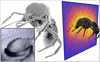
Researchers at Carnegie Mellon University have developed an efficient new way to quickly analyze complex geometric models by borrowing a computational approach that made photorealistic anima...
3D IMAGE BASED GEOMETRIC DOCUMENTATION OF A MEDIEVAL FORTRESS
3D model Orthophoto UAV Laser Scanning Photogrammetry
2019/3/4
The detailed and thorough documentation of monuments is a rather complex process that requires the application of the best available state of the art techniques in order to preserve, restore, promote ...
A NOVEL TECHNIQUE FOR PRECISION GEOMETRIC CORRECTION OF JITTER DISTORTION FOR THE EUROPA IMAGING SYSTEM AND OTHER ROLLING-SHUTTER CAMERAS
Europa photogrammetry jitter geometric correction active-pixel sensors
2018/5/14
We use simulated images to demonstrate a novel technique for mitigating geometric distortions caused by platform motion (“jitter”) as two-dimensional image sensors are exposed and read out line by lin...
HYBRID GEOMETRIC CALIBRATION METHOD FOR MULTI-PLATFORM SPACEBORNE SAR IMAGE WITH SPARSE GCPS
SAR image geometric calibration R-D model multi-platform TerraSAR-X TanDEM-X Gaofen-3
2018/5/15
Geometric calibration is able to provide high-accuracy geometric coordinates of spaceborne SAR image through accurate geometric parameters in the Range-Doppler model by ground control points (GCPs). H...
MODELING AND SIMULATION OF HIGH RESOLUTION OPTICAL REMOTE SENSING SATELLITE GEOMETRIC CHAIN
High Resolution Geometric Chain Modeling Simulation Geolocation Accuracy
2018/5/16
The high resolution satellite with the longer focal length and the larger aperture has been widely used in georeferencing of the observed scene in recent years. The consistent end to end model of high...
A MATCHING METHOD TO REDUCE THE INFLUENCE OF SAR GEOMETRIC DEFORMATION
SAR image image matching SURF SNCC geometrical deformations
2018/5/14
There are large geometrical deformations in SAR image, including foreshortening, layover, shade,which leads to SAR Image matching with low accuracy. Especially in complex terrain area, the control poi...
INVESTIGATION OF GEOMETRIC PERFORMANCE OF AN INDOOR MOBILE MAPPING SYSTEM
Mobile Laser Scanning Evaluation Viametris iMS3D Point Cloud Indoor Modeling
2018/6/4
Up-to-date and reliable 3D information of indoor environments is a prerequisite for many location- based services. One possibility to capture the necessary 3D data is to make use of Mobile Mapping Sys...
DETERMINING GEOMETRIC PARAMETERS OF AGRICULTURAL TREES FROM LASER SCANNING DATA OBTAINED WITH UNMANNED AERIAL VEHICLE
UAV LiDAR orchards tree height alpha-shape
2018/6/4
The estimation of dendrometric parameters has become an important issue for agriculture planning and for the efficient management of orchards. Airborne Laser Scanning (ALS) data is widely used in fore...
SCAN-TO-BIM OUTPUT VALIDATION: TOWARDS A STANDARDIZED GEOMETRIC QUALITY ASSESSMENT OF BUILDING INFORMATION MODELS BASED ON POINT CLOUDS
geometric quality assessment scan-to-BIM standardization Building Information Modeling point clouds
2018/3/5
The use of Building Information Modeling (BIM) for existing buildings based on point clouds is increasing. Standardized geometric quality assessment of the BIMs is needed to make them more reliable an...
GEOMETRIC ACCURACY ANALYSIS OF WORLDDEM IN RELATION TO AW3D30, SRTM AND ASTER GDEM2
Height model WorldDEM SRTM ASTER GDEM2 aerial LiDAR
2017/7/12
In a project area close to Istanbul the quality of WorldDEM, AW3D30, SRTM DSM and ASTER GDEM2 have been analyzed in relation to a reference aerial LiDAR DEM and to each other. The random and the syste...
The Geometric Calibration and Validation for The ZY3-02 Satellite Optical Image
the satellite ZY3-02 imaging geometric model geometric calibration interior orientation
2017/7/13
Chinese ZY3-02 satellite, which is the second of ZY3 series satellites, was launched in May 30th 2016 for complementing the mapping and earth observation. In order to eliminate various system errors o...
GEOMETRIC STITCHING METHOD FOR DOUBLE CAMERAS WITH WEAK CONVERGENCE GEOMETRY
Weak Convergence Stitching DEM Block Adjustment RFM
2017/7/12
In this paper, a new geometric stitching method is proposed which utilizes digital elevation model (DEM)-aided block adjustment to solve relative orientation parameters for dual-camera with weak conve...
MERGING GEOMETRIC DOCUMENTATION WITH MATERIALS CHARACTERIZATION AND ANALYSIS OF THE HISTORY OF THE HOLY AEDICULE IN THE CHURCH OF THE HOLY SEPULCHRE IN JERUSALEM
Geometric Documentation, Image based modelling, Terrestrial laser scanning, Non-destructive Techniques, Materials, Geomatics
2017/6/20
The National Technical University of Athens undertook the compilation of an "Integrated Diagnostic Research Project and Strategic Planning for Materials, Interventions Conservation and Rehabilitation ...
THE MAIN PORTAL OF THE CATHEDRAL OF MONREALE: FIRST GEOMETRIC ANALYSIS AND INTERPRETIVE ASSESSMENT OF ARCHITECTURAL FEATURES
Cultural Heritage Restoration Photogrammetry 3D survey 3D Modelling Monumental Portal
2017/6/20
Nowadays, 3D documentation of architectural assets is becoming a demanding task for the valorisation of Cultural Heritage especially after a restoration project. The 3D documentation can be used for d...