
�������: 1-15 ���鵽����ѧ Monitoring����ؼ�¼754�� . ��ѯʱ��(0.187 ��)
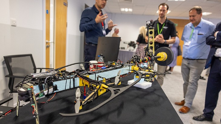
Ten projects funded by the Remote Monitoring of Sensitive Sites competition were shown at the UK's Defence and Security Accelerator (DASA) and Nuclear Decommissioning Authority's (NDA) demonstration d...
�й���ѧԺ�Ͼ������о���ר����Method for constructing groundwater monitoring well inside PRB wall
�Ͼ������о��� ר�� PRB ǽ�ڵ���ˮ ��⾮ ʩ������
2023/4/12
�й���ѧԺ�Ͼ������о���ר����Method for constructing groundwater monitoring well inside PRB wall��
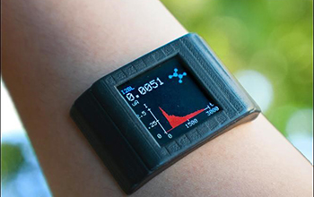
Adhesive film turns smartwatch into biochemical health monitoring system��ͼ��
Adhesive film turns smartwatch into biochemical health monitoring system
2020/7/3
Engineers funded by the National Science Foundation and affiliated with UCLA have designed a thin adhesive film that could upgrade a consumer smartwatch into a health-monitoring sy...
IMAGE RECORDING CHALLENGES FOR PHOTOGRAMMETRIC CONSTRUCTION SITE MONITORING
Image Recordings Recording Challenges Construction Site Monitoring Photogrammetry Construction
2019/3/4
Construction site monitoring and progress monitoring is becoming increasingly popular in the architecture, engineering and construction (AEC) industry. To this end remote sensing techniques are used t...
DEFORMATION MONITORING IN AND AROUND THE NATIONAL CAPITAL REGION OF INDIA USING DINSAR TECHNIQUE
Sentinel-1 DInSAR Deformation NCR, Vasundra
2019/2/27
Urbanization increases the pressure on land and ground water. Due to pressure on land and over extraction of the ground water for modernization and development, deformation of land increase. The tradi...
COMBINED ANALYSIS OF RADARSAT-2 SAR AND SENTINEL-2 OPTICAL DATA FOR IMPROVED MONITORING OF TUBER INITIATION STAGE OF POTATO
Crop dynamics Potato SAR RADARSAT-2 Sentinel-2 Red edge
2019/2/27
Tuber initiation and tuber bulking stages are critical part of various phenological phases for potato production. Tuber initiation covers the period from the formation of spherical rhizome ends, the f...
EVALUATING THE PERFORMANCE OF TERRESTRIAL LASER SCANNING FOR LANDSLIDE MONITORING
landslide monitoring terrestrial laser scanning scanning resolutions geodetic method deviation maps
2018/11/8
Nowadays, Terrestrial Laser Scanning (TLS) technology is gaining popularity in monitoring and predicting the movement of landslide due to the capability of high-speed data capture without requiring a ...
COMPARING THE PERFORMANCE OF POINT CLOUD REGISTRATION METHODS FOR LANDSLIDE MONITORING USING MOBILE LASER SCANNING DATA
point clouds, registration methods landslide monitoring mobile laser scanning deviation maps
2018/11/8
The aim of the research is to evaluate the performance of the point cloud registration methods using mobile laser scanning data. The point cloud registration methods involved in this research are matc...
DISASTER MONITORING AND EMERGENCY RESPONSE SERVICES IN CHINA
Emergency Response Service Disasters Satellite data Earth Observations
2018/5/15
The Disaster Monitoring and Emergency Response Service(DIMERS) project was kicked off in 2017 in China, with the purpose to improve timely responsive service of the institutions involved in the manage...
APPLICABILITY ASSESSMENT OF UAVSAR DATA IN WETLAND MONITORING: A CASE STUDY OF LOUISIANA WETLAND
Wetland Monitoring UAVSAR Polarimetric Synthetic Aperture Radar (PolSAR) Interfometric Synthetic Aperture Radar (InSAR)
2018/5/16
Wetlands are highly productive and support a wide variety of ecosystem goods and services. Monitoring wetland is essential and potential. Because of the repeat-pass nature of satellite orbit and airbo...
MONITORING DISASTER-RELATED POWER OUTAGES USING NASA BLACK MARBLE NIGHTTIME LIGHT PRODUCT
DISASTER-RELATED POWER NASA BLACK MARBLE LIGHT PRODUCT
2018/5/15
Timely and accurate monitoring of disruptions to the electricity grid, including the magnitude, spatial extent, timing, and duration of net power losses, is needed to improve situational awareness of ...
SNOW COVER MAPPING AND ICE AVALANCHE MONITORING FROM THE SATELLITE DATA OF THE SENTINELS
Snow Cover Ice Avalanche Sentinels
2018/5/15
In order to monitor ice avalanches efficiently under disaster emergency conditions, a snow cover mapping method based on the satellite data of the Sentinels is proposed, in which the coherence and bac...
VEGETATION MONITORING BY REMOTE SENSING TECHNOLOGY FOR UNINHABITED ISLANDS OF THE XISHA ISLANDS
the Xisha Islands Remote Sensing Uninhabited Island Vegetation Remote Vegetation Monitoring Island Development
2018/5/14
The Xisha islands are tropical coral islands in the south sea of China, with special ecological environment. As far away from the inland, they are more sensitive to climate change than inland, and are...
THE TRANSMISSION CHANNEL TOWER IDENTIFICATION AND LANDSLIDE DISASTER MONITORING BASED ON INSAR
Transmission Channel Transmission Tower Identification InSAR Time Series D-InSAR Landslide Monitoring
2018/5/14
The transmission distance of transmission lines is long, the line affected by the diversity of climate and topography of the corridors of transmission lines, differences in regional geological structu...
DYNAMIC MONITORING OF LAND COVER IN DONGTING LAKE AREA BETWEEN 1995�C2015 WITH LANDSAT IMAGERY
Dongting Lake, Land Cover, Remote Sensing, Classification, Transfer Matrix, Landscape Pattern
2018/5/15
In this paper, the Landsat imagery of 1995, 2006 and 2015 is used to monitor land cover change in Dongting Lake area. Our study mainly focuses on five types of land cover: water body, wetland, built-u...
�й��о����������а�-��
- ���ڼ���...
�й�ѧ���ڿ����а�-��
- ���ڼ���...
�����ѧ���л������а�-��
- ���ڼ���...
�й���ѧ���а�-��
- ���ڼ���...
�ˡ���-ƪ
- ���ڼ���...
�Ρ���-ƪ
- ���ڼ���...
��������-ƪ
- ���ڼ���...
�������� -ƪ
- ���ڼ���...
֪ʶҪ��-ƪ
- ���ڼ���...
���ʶ�̬-ƪ
- ���ڼ���...
��������-ƪ
- ���ڼ���...
ѧ��ָ��-ƪ
- ���ڼ���...
ѧ��վ��-ƪ
- ���ڼ���...